

每一天去了哪里
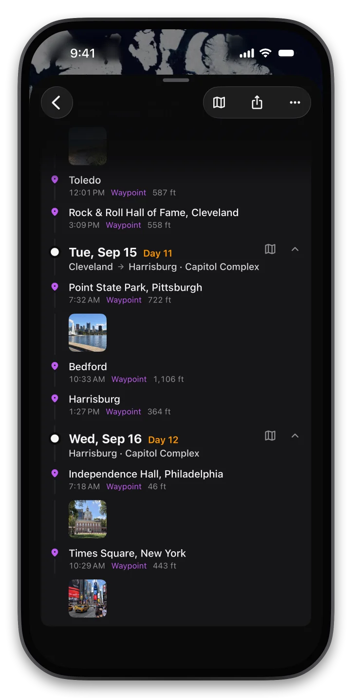
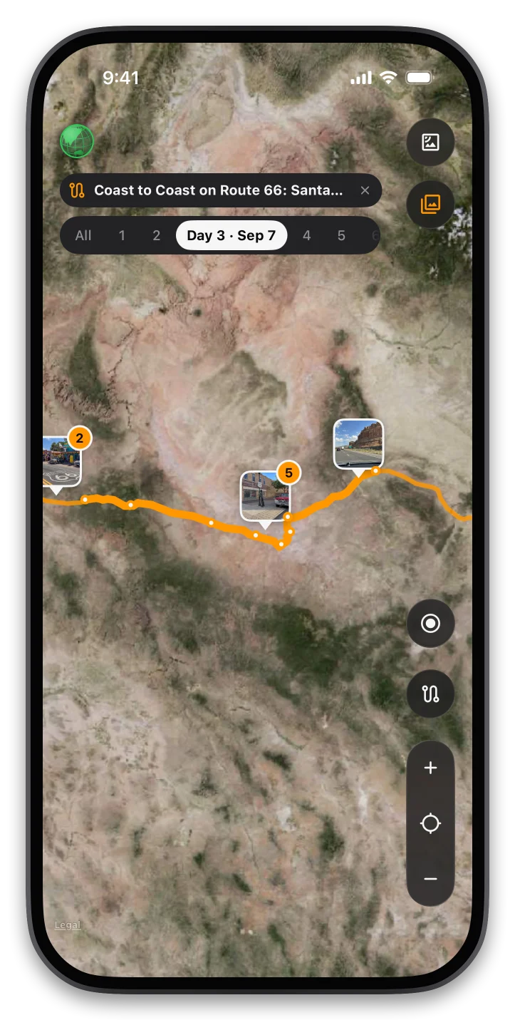
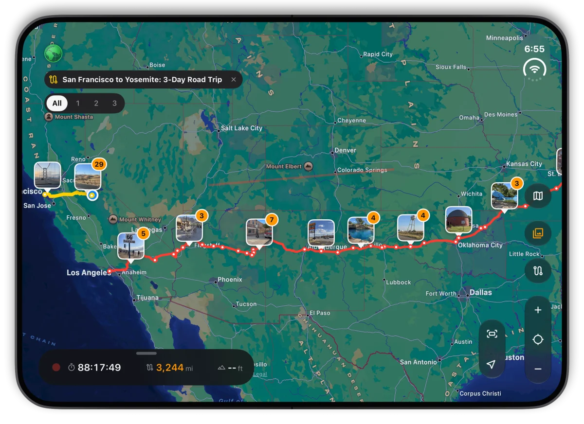
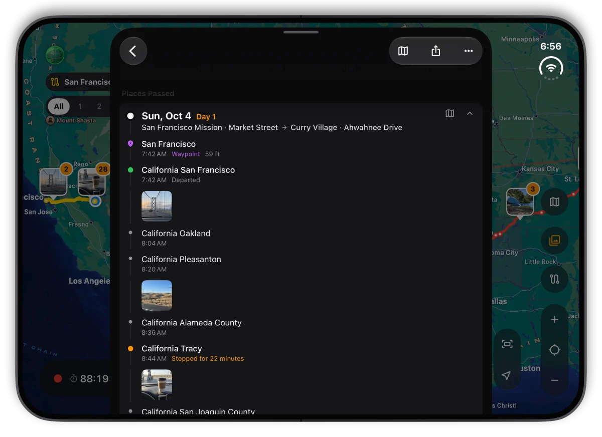
跨天的旅程按当地日期自动分成「第 1 天、第 2 天……」,每天写清楚从哪出发、到了哪里,途经和停留过的地方按时间排好。在地图上点一下某一天,就只亮出那天走过的路。
- check每天的起点和终点
- check途经地点和停留时长
- check地图上只看某一天
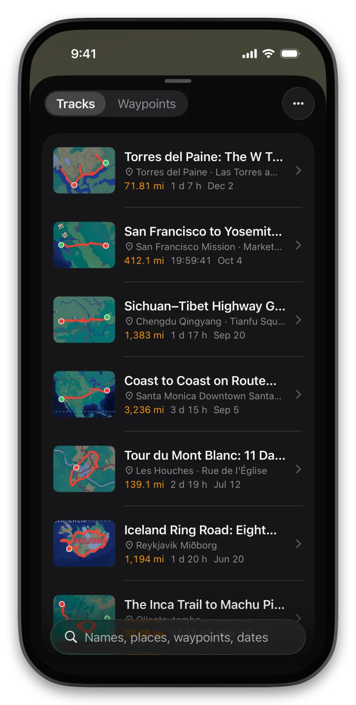
记下你的每一段徒步、骑行和自驾。回头打开,每一天从哪出发、到了哪里、在哪停留、沿途拍了什么,都按时间和地点整理好;也能沿着它再走一遍。离线地图,不用注册,数据只存在你的手机里。

手机扫码下载用手机相机或浏览器扫一扫,直接下载 Android 版

iPhone 扫码下载用 iPhone 相机扫一扫;中国大陆会自动打开 TestFlight
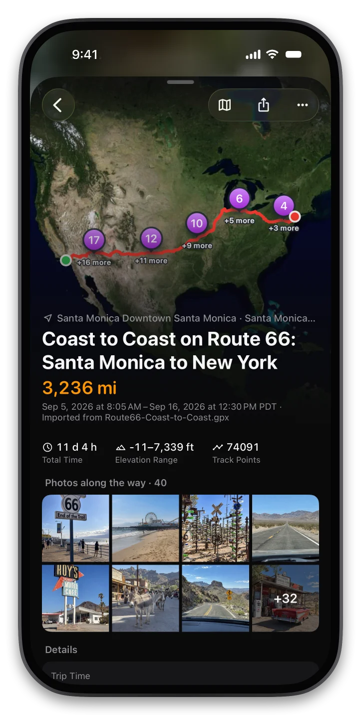
回到家打开行迹,一趟好几天的旅程,会自动整理成一本可以按天翻看的路书。
跨天的旅程按当地日期自动分成「第 1 天、第 2 天……」,每天写清楚从哪出发、到了哪里,途经和停留过的地方按时间排好。在地图上点一下某一天,就只亮出那天走过的路。
一路拍的照片和视频,会按拍摄时间自动放到轨迹上:地图上看得到每张照片拍在哪里,点开可以沿着轨迹一张张翻看,并显示当时的海拔和位置。没有定位信息的照片,也会按时间推算出大概的位置。


界面克制,只放出门时真正用得上的东西。
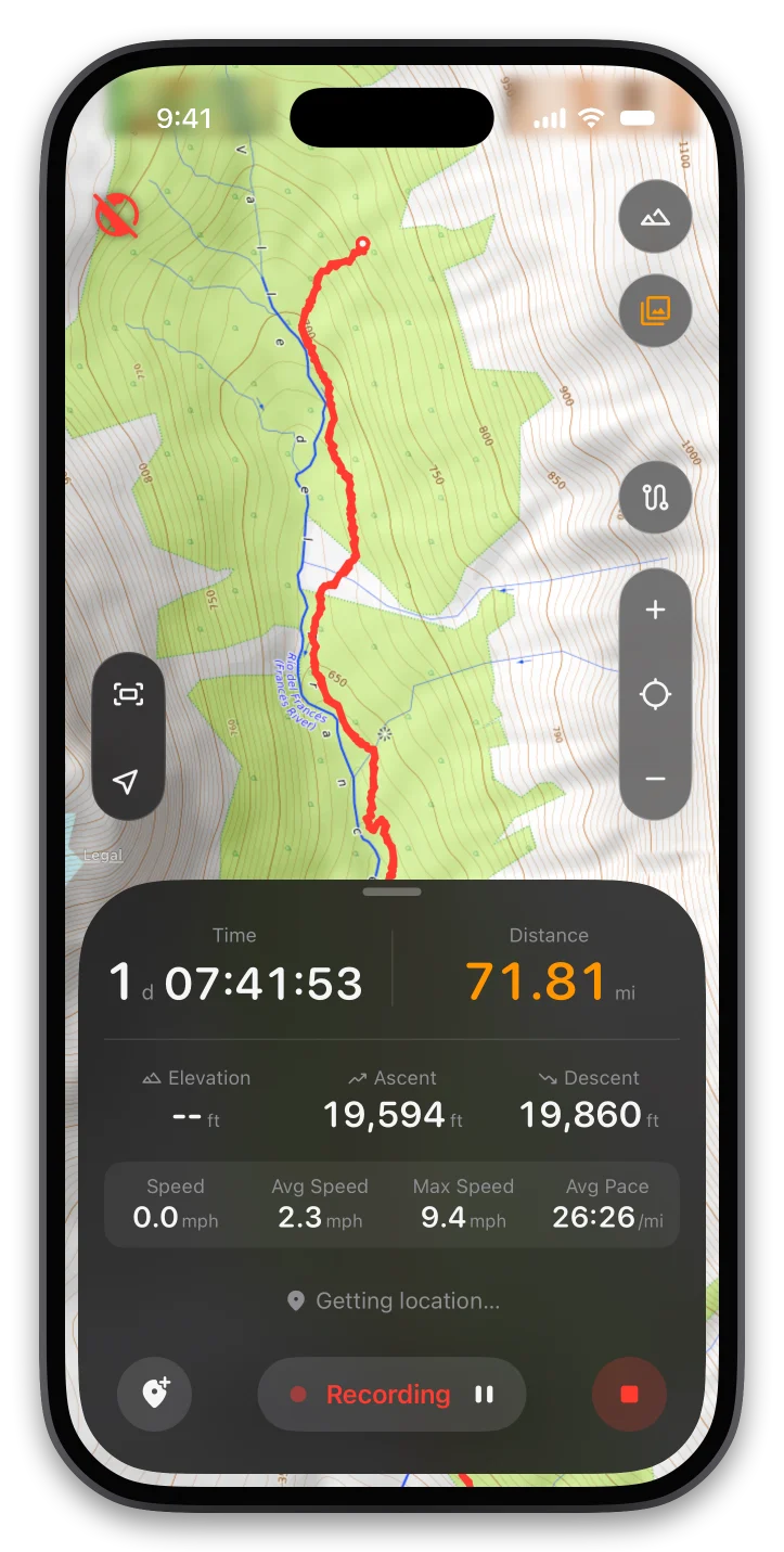
停下来自动暂停,出发自动继续;静止时降低定位频率省电。App 被系统关掉也能恢复,不丢轨迹。
载入走过或别人分享的轨迹,正向反向都能走。偏离路线、回到路线、到达终点都会提醒,可选中文语音。
天地图、OpenStreetMap、地形图、骑行图、卫星图随时切换,国内用天地图加载快、中文地名清晰。浏览过的区域自动缓存,没信号也能看。
每条轨迹都有海拔曲线、累计爬升和下降,以及距离、用时、平均速度和配速。
长按地图或在当前位置打点,记下停车处、水源、营地。随时看到距离和方向。
导入两步路、Google 地球等常见格式,也能导出分享。支持从文件、网址或其他 App 分享导入。
忘了停止、多录了一段?在地图上拖动起点和终点,裁掉不要的部分,距离、用时和海拔自动重新计算;也可以另存为新轨迹。
轨迹和航点存在你自己的 iCloud 里,换手机、删 App 都能自动恢复;每条轨迹还会另存一份 GPX 到 iCloud 云盘,在「文件」App 里就能看到。(iPhone 版)
简体中文、繁體中文、English、日本語、한국어、Español、Français、Deutsch。地名、日期和数字按你选的语言显示;公制或英制跟随系统,也可以手动切换。
iPhone 版截图,Android 版功能和界面基本一致。
展开是一块大地图,合上用外屏也一样顺手:按钮和状态栏统一放在侧边,把整块屏幕留给地图。
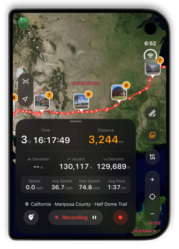
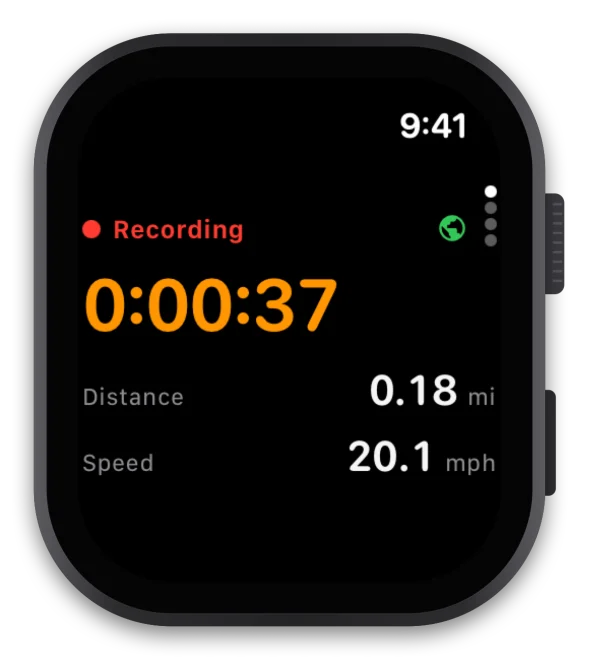
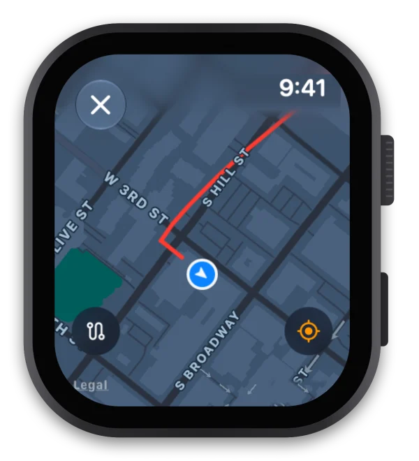
用 iPhone 记录时,Apple Watch 上实时显示用时、距离和速度,抬手就能看地图上走过的路;暂停、继续、标记航点都可以在手表上完成。
iPhone 版已在 App Store 上架(中国大陆通过 TestFlight 安装);Android 版可直接下载安装包。
手机扫码下载用手机相机或浏览器扫一扫,直接下载 Android 版
需要 Android 8.0 及以上(64 位 ARM,近几年的手机都支持)。
SHA-256: 380e11e12d1f9d32f9e134ab0e230db803ad38c9c21c86ff07ddfd1d8a23d129

iPhone 扫码下载用 iPhone 相机扫一扫;中国大陆会自动打开 TestFlight
中国大陆 App Store 暂未上架,请通过苹果的 TestFlight 安装:
名额 100 人,满员后暂停加入。测试版约 90 天有效,到期前会推送新版本。
你的路线是你自己的。
无需账号打开就能用,不收集姓名、手机号或邮箱。
数据只属于你轨迹和航点保存在本机,iPhone 版同时备份到你自己的 iCloud,删除 App 或换手机也不会丢;不经过我们的服务器,也没有第三方统计和广告 SDK。
只为地图联网联网只用来下载地图图块和查询地名(天地图 / OpenStreetMap / 系统地理编码),发送的只有坐标。
匿名改进统计,可关闭Android 版和 iOS 版每天发送一次匿名使用情况(版本、机型、语言、轨迹数量)和崩溃报告,存放在我们自己的服务器,不含位置和轨迹内容。可在 设置(iOS:地图与设置)› 帮助改进 iTrailog 关闭。
反馈只在你主动提交时发送在 App 里提交意见反馈时,会保存反馈正文、你选填的联系方式和截图,以及基础设备信息(机型、系统版本、App 版本、语言),仅用于改进产品。如需删除,请发邮件到 [email protected]。